Page content
Our researchers develop impactful projects and strategically target a wide variety of funders from the UK, EU, all-Ireland and trans-continental sources that have supported our research activities in six continents, thirty-one countries, three oceans and on Mars.
Our research has been funded by five of the nine UKRI Research Councils (NERC, AHRC, BBSRC, ESRC, STFC), GCRF, EU research programmes and other competitive national and international funding agencies.
Below is a selection of exemplar projects that showcase our research.
Projects

Funding: AHRC - Global Challenges Research Fund
Investigators: Dr Colin Breen
Partners: Ulster University, York University, Cambridge University, Uppsala University, Bournemouth University, Roehampton University
Project website: https://risingfromthedepths.com/
The Rising from the Depths network is funded for four years (2017-21) by the UK Global Challenges Research Fund through the Arts and Humanities Research Council Network Plus scheme.
Rising from the Depths aims to identify how the tangible submerged and coastal Marine Cultural Heritage of Kenya, Tanzania, Mozambique and Madagascar, and its associated intangible aspects can stimulate ethical, inclusive and sustainable economic growth in the region, of benefit not only to building social cohesion and reducing poverty in individual states, but also in enhancing the value and impact of overseas aid in the maritime sector. As part of the Network funding, we have a research fund for a range of Innovation Projects.
These projects will fill the knowledge gaps that currently limit the way Marine Cultural Heritage contributes to social, cultural and economic sustainable growth in Eastern Africa.
Funding: EU Northern Periphery and Arctic Programme 2014-2020
Investigators: Dr Paul Dunlop, Dr Sara McDowell, Dr Sara Benetti, Prof Sonya Coleman, Dr Dermot Kerr
Partners: Ulster University, The University Centre in Svalbard (UNIS), Irish Centre for High-End Computing (ICHEC) NUI Galway, Derry City and Strabane District Council, Donegal County Council.
The Arctic is undergoing rapid environmental change that is unprecedented in modern times. ‘Arctic amplification’ is rapidly destabilising the Arctic and has important implications for communities living in the NPA region.
Yet knowledge of, and resilience to these impacts are limited.
It is therefore critically important that we develop tools that can accurately monitor the nuanced impacts of climate change across this region in order to understand the pace of change and develop robust mitigation strategies that are tailored to the specific socio-economic, political and environmental contexts of NPA communities.
Such tools are also essential for creating greater awareness of the impacts of climate change that are not always understood outside the scientific community.
This interdisciplinary and multiscale project has two interconnected aims:
- to develop innovative, user-friendly tools to map the impacts of climate change required to explore the implications of this for NPA regions; and,
- to pilot these tools within three diverse NPA communities in the Arctic, sub-Arctic and mid latitude climatic zones within the NPA region to develop frameworks for building resilience that can then be disseminated to other communities across the NPA region.
ARCTIC will use high-resolution satellite imagery from the EU Copernicus programme and new computational advances in deep-learning methods and image analysis to develop new automated GIS tools that will accurately map the impacts of climate change across the NPA region and create user-friendly interfaces that will make this information accessible to a variety of stakeholders including local government, policymakers and community groups.
ARCTIC will develop a programme of community-level engagement strategies using the ARCTIC monitoring tools and existing climate change resources aimed at increasing awareness and scientific understanding of climate change science and its relevance for local communities across the NPA region.
Funding: NERC
Investigators: Prof Andrew Cooper (PI), Prof Derek Jackson, Dr Rory Quinn
Partners: Ulster University, Durham University, University of Maine, Trinity College Dublin, British Geological Survey, University of Ottawa, Geological Survey of Ireland
The two primary causes of global sea level rise are thermal expansion caused by warming of the ocean (water expands as it warms) and increased melting of land-based ice such as glaciers and ice sheets.
As Earth continues to warm due to climate change, rising sea levels will impact all coastal areas of the planet.
The human population, estimated at 7.6 billion in 2018, is expected to increase to in excess of 11 billion by 2100.
The majority of the world’s largest cities are located in coastal zones and more than 75% of people are expected to live within 100 km of the coast by 2025.
Therefore, future sea level change will have a profound impact on society, resulting in the loss of land, the submergence of many of the world’s coastal cities, the disappearance of low-lying islands, increased soil erosion, loss of coastal habitat, fresh water contamination and forced migration inland.
To mitigate against the consequences of sea level rise and better understand the rates and extent of future sea level change, we must look to the past.
This project investigates past sea level histories across the region once covered by the British-Irish Ice Sheet. The highly variable sea level history around Britain and Ireland means that the British Isles is a globally important location for studying the interactions between land, ice and the ocean during the profound and rapid changes that followed the last glacial maximum, approximately 21,000 years ago.
The British Isles sea level record is therefore an important yardstick for testing global models of land-ice-ocean interactions and this in turn is important for understanding future climate and sea level scenarios.
At present, the observational record of past sea levels in the British Isles is limited to shallow water areas because of accessibility and only the later part of the sea level history is well known. Over 4 years, we are collecting and analysing new high-resolution sonar data and sediment cores from the seafloor to better constrain this past sea level change. We will extend the observed sea level record using our new data and compare these to modelled predictions of sea level change. We can then modify ice model parameters to obtain better agreement with observations and thus better understand earth-ice-ocean interactions at all scales.
This project was funded by the Natural Environment Research Council, and led by Prof Andrew Cooper.
Funding: EU Horizon 2020
Investigators: Dr Carlos Loureiro (PI), Prof. Andrew Cooper (Co-PI)
Partners: Ulster University, University of KwaZulu-Natal, University of Bordeaux, University of Algarve
In today’s context of climate change with increasing risks to coastal areas caused by more frequent and intense extreme storms, sea level rise and the growing development pressure around the world’s coastlines, understanding and predicting how the coast changes is paramount for protecting and maintaining both natural and urbanized coasts. Along sandy beaches, coastal changes are the result of the complex interaction between waves, tides and sediments, and such complexity is enhanced in areas where rocky outcrops, headlands or coastal defence structures interrupt or constrain sediment movement. However, understanding and quantifying how sediment movement is constrained by the underlying surfaces, either rocky outcrops or older sedimentary layers, is still a main challenge in contemporary coastal research.
NEARCONTROL is a three-year project (2016-2019) funded through the EU Marie Skłodowska-Curie Actions that addresses this challenge by integrating a variety of surveying techniques and datasets, exploring state-of-the-art numerical models to investigate and simulate the evolution of sandy beaches that are bounded by headlands and overly rocky and sedimentary surfaces.
This innovative research project is being developed by team of scientists from Ulster, University of KwaZulu-Natal in South Africa, University of Bordeaux in France and University of Algarve in Portugal, bringing together expertise and knowledge from various areas of coastal research, including geomorphology, stratigraphy and high-performance modelling.
Modern ice sheets in Greenland and Antarctica are experiencing increased melting and ice loss under warming climate at a global level. This is resulting, among other things, in world-wide sea-level rise and changes in oceanic currents, which may affect in return weather and climate globally.
It is difficult to forecast what is going to happen to these very large masses of ice as little is still known about how such ice sheets behave under changing temperature. For scientists, such as glaciologists and ice sheet modellers, to be able to model accurately what is going to happen, they need more data about ice sheets. This is where the investigation of past ice sheets, which melted at the end of the last glacial period around 20,000 to 15,000 years ago, comes into play. Data on the pattern and timing of shrinking past ice sheets can provide key datasets for climate and ice sheet models.
The BRITICE-CHRONO Consortium, funded by NERC and led by the University of Sheffield, brought together around 80 scientists from UK, Ireland, Canada, USA and Norway with the aim of providing high quality data on the former British-Irish Ice Sheet that covered most of Ireland and Great Britain. Over 5 years we conducted a systematic and directed campaign to collect and date material to constrain the timing and rates of change of this past ice sheet.
Dr Sara Benetti was the PI of the project for Ulster University and she led the research work for two of the eight study areas that the project focussed on, covering terrestrial and marine work in County Donegal in Ireland, Northern Ireland and Scotland.
As all of the publications related to the project are being published, the British Irish Ice Sheet is fast becoming the best constrained ice sheet anywhere and a benchmark against which ice sheet models can be improved and tested.
Large (high-energy) volcanic eruptions and the resulting flow of volcanic debris pose a range of subaerial and submarine hazards, from the explosive events themselves to their capability of generating large tsunamis in the case of island or coastal volcanoes. In the case of volcanic islands our understanding of what happens once the volcanic flows move from air and land into the marine environment is still very limited. Also volcanic islands are often the tip of much larger, mostly submerged, volcanoes.
We know from previous research on volcanic islands that a lot more can be learnt about eruptions, the volcano’s history and related hazards by exploring the submarine part of volcanoes as a more complete record is preserved there compared to their terrestrial counterparts.
The project PANTHER, led by Dr Sara Benetti, has brought together scientists from the UK, Ireland, Italy, Spain and the Netherlands to reconstruct the effect of past large volcanic eruptions on the seafloor around the Italian island of Pantelleria, a prime example of an active, mostly submerged, volcano.
This project started with a research cruise around Pantelleria in August 2016 funded by the EU’s Research Infrastructure programme EUROFLEETS.
This programme allowed scientists to transnational access to research vessels from other European countries.
Hear the scientists on board talk about their experience on the Italian research vessel Minerva 1.
The research on the material collected during the research cruise is ongoing and further funding for analyses and research has been provided by NERC and the EU’s Erasmus+ programme.
Funding: EU INTERREG VA Programme
Investigators: Professor Phil Jordan, Dr Richard Douglas and Professor Brian Rippey
Partners: Ulster University, British Geological Survey, Geological Survey Ireland, Donegal County Council, Agri-Food and Bioscience Institute, Inland Fisheries Ireland, Loughs Agency of the Foyle, Carlingsford Irish Lights Commission, Armagh City Banbridge & Craigavon Borough Council.
The quality of our rivers and lakes across the island of Ireland is important for providing high-quality drinking water, supporting livelihoods such as agriculture and also for biodiversity, angling and water sports. This quality can be impacted by historical or present day activities in upstream catchment areas. Despite legislation in place for many years to protect water bodies, quality has not improved as anticipated and so community based actions are being tested alongside regulations as demonstrations of good practice.
In undertaking these demonstrations the aim in CatchmentCARE is to provide a platform for cross border engagement and knowledge sharing between community, governance, policy and scientific stakeholders.
Our work includes the management of critical source areas of pollution, soil nutrient management planning with farmers, fish passage barrier removal and restoration of riverbanks, improving the quality of discharges from rural wastewater plants and rapidly modifying the chemistry of vulnerable lakes. Outcomes from this approach will feed directly into EU Water Framework Directive planning in the Republic of Ireland and into Northern Ireland water quality policy in the years following EU departure.
We are working with a large partner consortium led by Donegal County Council and including Geological Survey Ireland, British Geological Survey, Agri-Food and Bioscience Institute, Inland Fisheries Ireland, Loughs Agency, and Armagh City, Banbridge and Craigavon Borough Council.
The €13.8million CatchmentCARE project is funded (2017-2022) through the European Union’s INTERREG VA Programme, which is managed by the Special EU Programme’s Body. There is support from the Department of Agriculture, Environment and Rural Affairs Northern Ireland and the Department of Housing, Planning and Local Government in the Republic of Ireland. Geography and Environmental Sciences staff are Prof Phil Jordan, Dr Richard Douglas, Prof Brian Rippey, Dr Julie Campbell, Gabriel Gaffney, Peter Devlin and Clara Murray.
Funding: Arcadia Foundation
Investigators: Dr Colin Breen (PI), Dr Kieran Westley, Dr Wes Forsythe, Dr Rory Quinn, Dr Ruth Plets
Partners: Ulster University, Southampton University, Oxford University
MarEAMENA, funded for a five-year period from January 1st 2019, will record endangered environments and heritage under threat from conflict, climate change and development in the coastal regions of the Middle East, North Africa and the Gulf.
The project team will work with the established EAMENA team at Oxford University to further develop an open access digital platform of sites and landscapes under threat and undertake a programme of training and capacity building with the region’s heritage and environment agencies and personnel.
EAMENA’s primary aim is to rapidly record and evaluate the status of the archaeological landscape of the MENA region in order to create an accessible body of data which can be used by national and international heritage professionals to target those sites most in danger and better plan and implement the preservation and protection of this heritage.
Funding: EU Interreg VA, Department of Agriculture, Environment and Rural Affairs in Northern Ireland, Department of Housing, Planning and Local Government in Ireland and Scottish Natural Heritage.
Investigator: Dr Joerg Arnscheidt
Partners: Ulster University, Newry, Mourne and Down District Council, AFBI, IT Sligo, ACT, East Border Region, Golden Eagle Trust, Scottish Natural Heritage, Armagh City, Banbridge and Craigavon Borough Council, Monaghan County Council, Ulster Wildlife Trust
This project supports conservation efforts in rare and very sensitive natural habitats and for the protection of iconic species such as birds like the hen harrier, golden plover and red grouse, the marsh fritillary butterfly and the white-clawed crayfish. With our project partners we are working on hard water lakes and their associated wetlands in the cross border area between counties Fermanagh and Monaghan and at Lough Arrow in county Sligo. These lakes were once known for their clear water. Sadly, this has now become a very rare feature. An excessive availability of plant nutrients like phosphorus appears to be the cause for frequent algal blooms, changes in water plant communities and declining crayfish numbers. The project will therefore assess the current status of crayfish populations, identify critical nutrient sources and test options for lake restoration.
Funding: AHRC
Investigators: Wes Forsythe, Colin Breen and Rosemary McConkey
Salt has been a vital commodity for human life down through the ages. Crucial for the preservation of food, it enabled people to maintain provisions at home as well as to export perishable trade goods, such as meat, fish and butter. This was a particularly important aspect of Ireland’s predominantly agricultural trade. This project is the first attempt by archaeologists to systematically identify and understand Ireland’s sites of salt production. The study explores the remains and techniques of salt manufacture, and assesses the development and extent of trade and its social implications.
Salt production in Ireland was predominantly coastal and represents one of the most direct means of exploiting the marine environment – by utilising the saline nature of seawater. During the course of fieldwork many new sites were discovered and documented, and a major campaign of excavation was carried out a complex of sites which span the 17th-19th centuries. The project findings demonstrate the challenging environment (physical and socio-political) that salt makers had to deal with; as well as the opportunities that drew the country more deeply into transatlantic trading networks.
Funding: Department for Communities
Investigator: Dr Paul McKenzie
Fuel poverty occurs when a household needs to spend more than 10% of its income on keeping warm. Northern Ireland is one of the worst affected areas in the UK, with the rate of fuel poverty in Northern Ireland often above 40%. Difficulties in heating homes are caused by low incomes, expensive fuel types and inefficient buildings. Living in cold, damp homes can have a significant impact on the health and wellbeing of residents and has been linked to high Excess Winter Mortality rates across the UK and Europe. Furthermore, fuel poverty can also restrict behavioural patterns which can negatively affect our communities as a whole.
With fuel poverty such a critical issue across the UK and Ireland, there is an urgent need to target interventions to those in greatest need.
Fuel poverty schemes in Northern Ireland historically relied on self-referral which often meant that people experiencing extreme fuel poverty did not avail of funding. More recently there has been a move toward area-based targeting schemes that use large datasets. By determining variables that indicate risk of fuel poverty it is possible to identify and target resources to those in greatest need.
Our aim was to come up with a solution for targeting which areas were most at risk of fuel poverty.
We worked with the Department for Communities to develop a highly effective area-based targeting algorithm which identifies small areas that are at increased risk of experiencing fuel poverty. We did this by integrating a range of datasets relating to income, building energy efficiency measures, fuel prices, building types and many others. These variables were weighted to produce a final risk index to indicate groups of homes that were at risk of fuel poverty.
Our approach has now been adopted by the Affordable Warmth Scheme (Northern Ireland’s Domestic Energy Efficiency Programme) for addressing fuel poverty in the private sector. This has meant that they are better able to target resources to those who may be experiencing fuel poverty. This scheme has been delivered across Northern Ireland by the Housing Executive and local councils. Between 2014 and 2018 the Affordable Warmth Scheme has helped almost 16,000 homes and approximately 42,000 people. On average, each eligible household received a grant of over £4,000 with some properties receiving £10,000 for a host of energy efficiency measures. From a recent Health Impact Assessment carried out in partnership with Sheffield Hallam University it is estimated that gains in wellbeing equate to over £93 million while reductions in NHS costs are estimated to equate to over £4 million. The value of improved mental health conditions on increased working days is estimated to be almost £5 million. It is expected that many of the most vulnerable people in Northern Ireland will enjoy greater health and wellbeing as a result of the Affordable Warmth Programme.
This project was funded by the Department for Communities, and led by Dr Paul McKenzie.
You can read associated publications here (link back to publications page).
Funding: EU Marie Skłodowska-Curie ITN
Investigators: Dr Paul Dunlop, Dr Sara Benetti, Dr Kevin Schiele
Partners: Ulster University, University of Bergen, Durham University, University of Tromso, University Centre in Svalbard, Scottish Association for Marine Sciences, Denmark and Greenland Geological Survey, North Energy, Volcanic Basin Petroleum Research, Statoil
Project website: http://www.glanam.org
The North Atlantic continental margins extend from the Arctic to the southwest of Ireland in water depths below sea level ranging from around 100 m close to shore to 350 m at the shelf edge. During the Ice Ages, large ice sheets in Greenland, Iceland, Svalbard, Norway, Britain and Ireland expanded offshore into the Atlantic and onto the continental shelf creating glacial landforms and delivering huge amounts of sediment to the seafloor that can be used to investigate their growth and decay through time.
Over the last 20 years, there has been a large research effort, involving both industry and academia, which has contributed to our current understanding of the history of these ice sheets and their influence on glaciated North Atlantic margins. However, despite these advances, major gaps remain in our understanding. For example the full extent and retreat patterns of the ice sheets surrounding the North Atlantic remains poorly defined for many areas, yet this needs to be properly investigated if we are to understand the times in Earth’s history when it was cold enough for ice sheets to form and then warm enough for them to melt again.
The glaciated North Atlantic margins are therefore key locations for helping us better understand the climate history of our planet and the processes involved in driving climate change. The Antarctic Ice Sheet (WAIS) which rests 1 km below sea level, is similar to the past ice sheets of the North Atlantic as it has also expanded onto its continental shelf. Understanding the glacial history of the North Atlantic margins provides us with a great opportunity to better understand how marine ice sheets such as the WAIS might respond to ocean warming.
This is really important given that the WAIS has the potential to raise sea levels by over 3 m if it collapses and would have huge societal implications for coastal communities across the globe.
The North Atlantic margins are also important for future energy supplies and contain significant oil and gas reserves that are important for industry and European economies. Understanding the nature of the continental margin and its glacial sedimentary history is a fundamental pre-requisite for successful hydrocarbon exploration, as many potential reserves remain buried beneath glacial sediments.
Understanding the sedimentary history of the region is central to developing and testing models of reservoir depth and for locating and managing new reserves. In addition, glacial sediments on the shelf have caused underwater landslides in the past resulting in Tsunamis in the North Atlantic. Since sedimentary sequences on the shelf could potentially slip again it is important to investigate whether they still represent a threat to coastal communities in the North Atlantic.
Collectively, these knowledge gaps and the requirements of industry represent a major challenge that requires the next generation of European researchers to be equipped with the range of appropriate skills, expertise and knowledge at the interface of both academia, applied research and commercial interests.
The GLANAM Initial Training Network was designed specifically to address this shortcoming through the establishment of a multidisciplinary network, which trained young researchers in skills relevant to academia and industry. GLANAM consisted of 10 research partners from Norway, UK and Denmark and including 6 University research teams, 2 industrial full partners and 2 industrial associate partners.
The overarching scientific goal of the GLANAM network was to determine the controls on the development in time and space of glaciated continental margins and employed 15 early career researchers to undertake co-ordinated PhD or post-doctoral research programmes to address five key objectives:
- To determine the role of different glacial/non-glacial sedimentary processes in shaping the glaciated North Atlantic margins
- To contribute to the understanding of the extent, timing and rates of decay of marine-based ice sheets.
- To contribute to the understanding of the influence the ice ages have imposed on the hydrocarbon systems on the glaciated North Atlantic margin including sedimentation rates/location of depo-centres, subsidence/tilting and direct ice loading through multiple glaciations.
- To determine the influence of climate change and sedimentary processes on the fluid flow (and gas hydrate) systems on the glaciated North Atlantic margin.
- To identify the controlling factors and the role of submarine mass movements (with resulting tsunamis) on the glaciated North Atlantic margin.
GLANAM was funded by the EU Marie Skłodowska-Curie ITN programme.
You can read more details on the project, the early career researchers their projects and the associated publications at http://www.glanam.org
Funder: AHRC
Investigators: Dr Sara McDowell, Dr Maire Braniff
Partners: Ulster University, QUB
As Northern Ireland works through its Decade of Commemorations (leading up to the centenary of its contested creation in 2021) the challenges facing public bodies to mediate partisan narratives of the past and diffuse associated tension and violence has perhaps never been greater.
Commemorative-related violence remains a potent symbol of continuing divisions and has important ramifications for a society in transition.
Yet an integral part of transforming this type of violence is engaging with and learning from remembrance practices that do not tend to instigate violence, or those places where violence has subsided throughout the 'post-conflict' years.
This project emerged from the outcomes of our previous AHRC project, 'Place or Past?' and works from the premise that there are examples of good practice within how the past is remembered and commemorated in specific places throughout Northern Ireland.
With a view to enhance present and future practice and approaches to commemoration, this project has been evaluating and sharing 'good' practice and promoting knowledge exchange between those who are involved in commemoration and remembrance and the public bodies who are tasked with responding to and managing commemoration in a post-conflict context.
Our project partners include: The Police Service of Northern Ireland, the Department of Culture, Arts and Leisure, the Northern Ireland Community Council and The Junction.
Funding: EU INTERREG VA Programme
Investigators: Professor Phil Jordan
Partners: Ulster University, NI Water, Irish Water, Rivers Trust, Agri-Food Biosciences Institute, East Border Region
As a society we expect our drinking water to be of the maximum quality and treated water distributed to consumers is rightly regulated to the highest standard.
A large proportion of drinking water sources is mainly from upland areas across the island of Ireland where industrial or urban contamination is minimal and this can minimise treatment costs before distribution to consumers. In recent years, however, notable treatment costs by Northern Ireland Water and Irish Water from upland catchment sources have included the removal of pesticides, turbidity from sediments and colour from dissolved organic matter. Pesticides, and particularly the selective herbicide MCPA, have increased in occurrence in these source waters entering treatment plants and their removal to appropriate standards is expensive.
A way to offset these treatment costs is to provide more effective management of pesticide, sediment and organic matter pressures in upstream catchment areas. In the uplands these pressures come from MCPA applications to rush plants growing on grassland, erosion from riverbanks and fields and from areas of disturbed peatland. Our aim in the Source to Tap project is to identify these pressures and then offer alternative management through incentive schemes and also demonstration of local mitigation measures in a pilot catchment, the cross border Derg River.
This approach is being complimented with a comprehensive education and engagement programme ranging from schools to farming groups.
Our role in the project, led by Prof Phil Jordan, is to provide a monitoring solution to the incentives and mitigation measures and to understand the role weather and climate play on MCPA, sediment and organic matter flux from catchments. We are working with Northern Ireland Water, Irish Water, Rivers Trust, Agri-Food Biosciences Institute and East Border Region.
Source to Tap is funded from 2016 to 2022 through the European Union’s INTERREG VA Programme, which is managed by the Special EU Programme’s Body. There is support from the Department of Agriculture, Environment and Rural Affairs Northern Ireland and the Department of Housing, Planning and Local Government in the Republic of Ireland with a total budget of €5.3million.
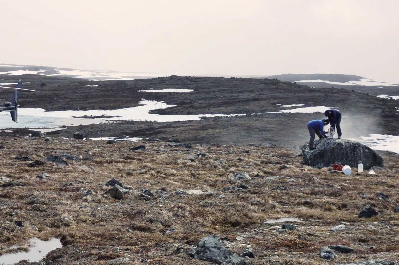
Funding: NERC - UK and Canada Arctic Partnership
Investigator: Dr Paul Dunlop
Partners: Ulster University, Université du Québec à Montréal, Bureau de l'exploration géologique du Québec
The large ice sheets that covered vast expanses of the Northern Hemisphere during the last Ice Age formed climatically controlled systems that were also able to impact Earth’s climate.
A prime example of this is the climate variability that existed during the last deglaciation (between 15,000 to 7,000 years ago) is linked to the drainage of freshwater into the North Atlantic from large lakes that developed along the outer edges of the Laurentide Ice Sheet over eastern North America.
As this ice sheet melted, the northward retreating ice margin dammed large amount of meltwater, forming large lakes along its front. Around 8200 years ago, the ice sheet thinned enough to allow the lakes to burst into Hudson Bay (Canada) and an estimated one hundred Trillian cubic meters of meltwater spilled out into the North Atlantic Ocean. This massive freshwater discharge disrupted the Gulf Stream, which regulates Earth’s climate, thereby inducing a period of climatic cooling that lasted two hundred years in continental Europe.
This same process is now back in focus again due to a growing number of studies that show a present-day increase of freshwater flowing into the North Atlantic from Greenland and other Arctic glaciers may potentially lead to a slowdown of ocean circulation and cause important climate feedbacks.
This Natural Environment Research Council (NERC) funded collaboration brings together researchers from Ulster University and Université du Québec à Montréal (UQAM) to collaborate on a Natural Sciences and Engineering Research Council of Canada (NSERC) funded project being lead by researchers in UQAM, who are reconstructing the deglacial history of the northeastern sector of the Laurentide Ice Sheet in northern Quebec (Nunavik), where large meltwater events are likely to have originated in the past.
The region surrounding Ungava Bay in north-central Quebec and Labrador is a strategic position to unravel these issues because it hosted the last remnants of the ice sheet, which were responsible for the damming of large glacial lakes that occupied the main river valleys and other topographic depressions.
This region has a spectacular landscape that is characterized by various glacial/de-glacial landforms that are key to understanding the deglacial history of this sector.
A key objective of this collaboration is to map the deglacial landscape of the Puvirnituq region of the Ungava Peninsula in Nunavik using high-resolution satellite imagery (RapidEye: 5m; Pléiades: 0.5 m) and conduct extensive fieldwork to sample large glaciomarine deltas and ice-contact deposits for cosmogenic dating.
This work is part of a large East-West sampling transect that crosses the entire Ungava Peninsula, which is aimed at constraining the chronology of ice retreat and the timing of the final disappearance of the ice sheet.
Overall, this collaboration will provide a new mapping framework aimed at improving our understanding of ice sheet retreat during the final stages of the deglaciation in Nunavik.
Funder: Northern Ireland Executive Office
Investigators: Dr Sara McDowell, Dr Maire Braniff, Dr Jonny Byrne
Tourism can be a significant driver of peace in societies emerging from conflict.
Our project works alongside communities in three interface neighbourhoods in Northern Ireland to develop tourism initiatives around heritage and conflict-related sites.
The work is funded by the Northern Ireland Executive through the Together: Building A United Community programme which aims to build capacity, foster positive community identities and attract investment in disadvantaged areas where there has been a history of tension.
Funder: European Union’s INTERREG VA Programme
Investigators: Professor Derek Jackson; Professor Andrew Cooper, Dr. Chris McGonigle
Partners: Ulster University, Agri-Food and Biosciences Institute (lead), Marine Scotland and Scottish Natural Heritage, University College Cork; Scottish Association for Marine Science and BirdWatch Ireland
Project website: http://www.mpa-management.eu/
Active management of our coasts and seas is increasingly important in a changing world, and it is vitally important to understand how effective current management interventions are so we can understand the dynamics of these systems and plan for the future. Marine Protected Area Management and Monitoring (MarPAMM) is a 3.5-year environmental project to develop tools for monitoring and managing a number of protected coastal marine environments in Ireland, Northern Ireland and Western Scotland. Being able to better understand the physical and biological processes operating at the network of sites will enhance management across a range of locations and allow best practice across the range of partners. Our aim is to understand the physical and biological processes affecting the coastal environment and its marine species. This will improve management, conservation and sustainable development of the marine resource, including engagement with a wide variety of stakeholders.
We work with Agri-Food and Biosciences Institute (lead), Marine Scotland and Scottish Natural Heritage), University College Cork; Scottish Association for Marine Science and BirdWatch Ireland to collect data on the abundance, spread and movement of marine protected species and habitats. This will help us produce new habitat maps and develop models for a range of species.
Our next steps in this project will be the production of a regional model of protected seabed-dwelling species and habitats, development of new and existing monitoring methods and a coastal processes model.
This project was funded by Interreg VA and the work at Ulster University has three investigators; Professor Derek Jackson, Professor Andrew Cooper and Dr. Chris McGonigle
You can read more about the project here (http://www.mpa-management.eu/)
Funding: AHRC - Global Challenges Research Fund
Investigators: Dr Wes Forsythe
Partners: Ulster University, Eduardo Mondlane University and the University of Roehampton
Project website: https://risingfromthedepths.com/
The coast of Northern Mozambique has been part of the Indian Ocean trade network from the 7th century, giving rise to a vibrant maritime culture of settlement, travel and exchange. One of the most well-known sites is Mozambique Island, a major port of significance for East African maritime trade from the 14th century. It became the capital of Portuguese colonial government from 1507 and its architectural diversity was recognised by UNESCO World Heritage Site designation in 1991. Despite the wealth of archaeological sites located in the waters around the Island, successive salvage operations have been carried out in the past for commercial gain. These have disturbed the integrity of shipwrecks lying in the area, to the chagrin of the local community. The region remains vulnerable to a range of human and natural environmental pressures.
This project aims to support Mozambican archaeologists by carrying out a range of activities designed to gather a more accurate information on the historic sites around Mozambique Island, to develop better understandings of the natural landscape they lie in, and to engage the local community by exploring the folklore associated with the marine environment.
Working with colleagues from Eduardo Mondlane University and the University of Roehampton we will be carrying out geophysical survey to explore the seabed and sea-level change, dive survey aimed at recording submerged sites of importance and a community / schools project to engage all age groups in telling the stories of life on the coast.
This project is funded by the Global Challenges Research Fund, and led by Dr Wes Forsythe.
Funding: AHRC - Global Challenges Research Fund
Investigators: Dr Wes Forsythe
Partners: Ulster University, National Museums of Kenya, the British Institute in East Africa and the Documentary Institute of Eastern Africa.
Project website: https://risingfromthedepths.com/
Near Malindi on the coast of Kenya are two outstanding national parks on the fringe of Mida Creek. However, investment on the margins of these parks commonly takes the form of tourist accommodation and facilities with limited community benefit. Mangrove deforestation, fisheries depletion, rising sea levels and increased soil salinity make even the most fundamental subsistence activities within this enclave a pressing challenge. The inhabitants of the area have a rich history of sustainable engagement with their marine environment and have undertaken a number of initiatives such as creating trails and product development. This project will support and develop such initiatives by celebrating the cultural and natural landscape and investing in new infrastructural, educational and economic opportunities.
This project aims to establish a ‘must-visit’ interpretive centre in an archaeologically significant, ecologically sensitive, and economically deprived area. This traditional, Indian Ocean dhow-house will run workshops on traditional boat and canoe building, teach important skills and values to youth groups about the region’s rich marine heritage. Archaeological landscape survey will bring new sites to light to enrich the visitor experience and the project will train a local women’s group how to incorporate maritime heritage into their already existing alternative and additional livelihood (AALs) strategies.
The work will be conducted with colleagues from the National Museums of Kenya, the British Institute in East Africa and the Documentary Institute of Eastern Africa.
This project is funded by the Global Challenges Research Fund, and led by Dr Wes Forsythe and his East African partners.
In this section

Bordered Youth
Young people living in the North of Ireland are put into boxes which perhaps do not adequately represent their views and opinions – the Bordered Youth Project seeks to change that.