A project examining the shifting shorelines of Northern Ireland over the last 193 years, has recently been completed by Ulster University, revealing for the first time, a detailed picture of coastal change. Using historical maps and aerial photographs, the team of researchers have painstakingly examined what changes have taken place from the historical times right up to present day.
The project, funded by DAERA (Department of Agriculture, Environment and Rural Affairs), has taken over a year to complete and represents some of the most detailed analysis possible for examining historical changes on coastlines. Utilising the first (circa 1830) detailed Ordnance Survey maps of Northern Ireland’s coast and intervening mapping surveys, vertical aerial photographs (from the 1950’s to present day) as well as a recent coastal topographic LiDAR (Light Detection and Ranging) survey undertaken by DAERA, each 25-metre section of the Northern Ireland coastline was investigated for positional changes.
Lead researcher on the project, Professor Derek Jackson, an expert on coastal processes, said "The project was a huge technical task in itself but, in the end, it has produced a fantastic database from which to better understand how the Northern Ireland coastline has changed over historical times.’ For the first time, Northern Ireland now has a detailed picture of how dynamic, particularly the sandy stretches, of the coastline are. This now gives ‘...a much better scientific basis from which to manage these sites in the future." he said.
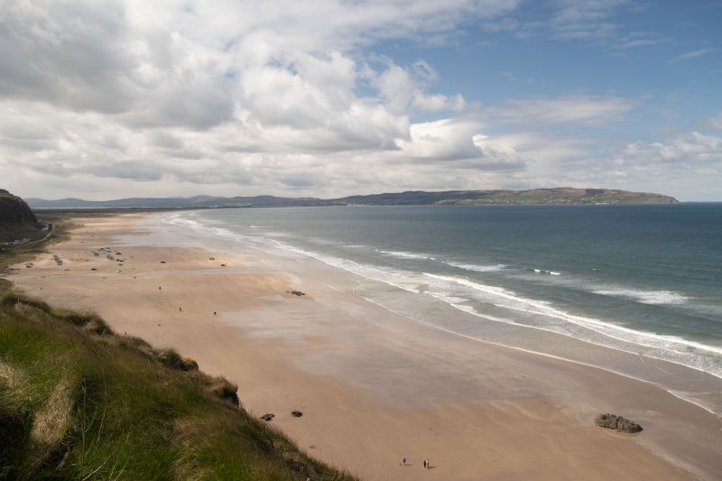
Co-Investigator on the project, Professor Andrew Cooper said “The largest shoreline advancements recorded in the last two centuries along the Northern Ireland coastline were all induced by human modifications such as extensive land reclamation in sea loughs (mainly during the 19th century), construction or expansions of ports and harbours, power stations, wastewater treatment areas or touristic facilities. Rocky coasts, apart from limited rockfalls, were less subject to largescale changes as were shorelines not influenced by human-modified in sea loughs. Minor changes were also recorded in the offshore islands. The largest ‘natural’ shoreline erosion levels were recorded on the western side of Magilligan Point (Co. Londonderry), while the largest shoreline advancement over the last two centuries was found in at Murlough’s (Co. Down) sand spit”.
Open-coast sandy shorelines showed various levels of erosion, apart from build up at the Castlerock-Portstewart Strand complex (due to the extensive jetties at the river Bann entrance which are trapping sand from both directions) and Ballykinler (linked to local geology and inlet exchanges between the inner and outer Dundrum Bay).
Professor Jackson also added "The project also examined areas where coastal processes are concentrated, inside which sediment is largely contained and moved around. A total of seven of these zones, known as ‘Coastal Cells’, were identified, which again helps in future coastal management approaches."
The work undertaken is part of a series of recent initiatives by DAERA to gather detailed information on the coast. Through the Northern Ireland Coastal Forum and the associated working group, DAERA has been addressing the shortfall of scientifically robust data on how the coastline is changing. This much needed evidence will be used to identify the areas most vulnerable to coastal change and will provide reliable scientific evidence which will inform decision-making, as well as the development of plans and policies required for sustainable coastal management.
DAERA is working closely with ESRI Ireland to make all this data publicly available via the Northern Ireland Coastal Observatory. Within the Observatory all data collected by DAERA for the coast can be viewed and accessed for use.